Tuesday, July 25, 2017

Pere Marquette Rail-Trail - Evart to Farwell, MI

It was 63 degrees Monday, July 24, 2017, at 11:00 am when we began our ride of the Pere Marquette State Trail out of Evart, MI.  The section we are riding today begins at Evart and goes east through Lake and then to Farwell.  Each of these towns offers staging areas, and Farwell has two staging areas.
The trail is paved with asphalt, is wide, and is well maintained.  The picture on the left is the old train depot which now serves as a community center and holds some city offices.  There is a huge parking area at this trailhead.  We noticed someone had brought their travel trailer and parked it in the lot.  There was plenty of room.

Almost immediately upon leaving town we found this beautiful old bridge taking us across the Muskegon River.  On the right is the Muskegon River viewed from the bridge.


Pictured here are 2 of the 3 tunnels we cycled through.


It is fun to ride the rail trails knowing that there was once a train that passed this way quite frequently, and most likely there were people on the train looking out the windows seeing some of the same beauty we are seeing.  This was a gorgeous trail and we had such a perfect day in which to take in all of nature's best!


We saw farmlands, lakes, marshes, wildflowers, and many trees.

Loved the "sled parts" sign!
Can you imagine being on the trail in the winter and needing "sled parts"!  Oh my!

From Evart it is 13.6 miles to the town of Lake (our Michigan Trails book says Lake Station).  The picture on the left is the old train station along with a section of the old train.
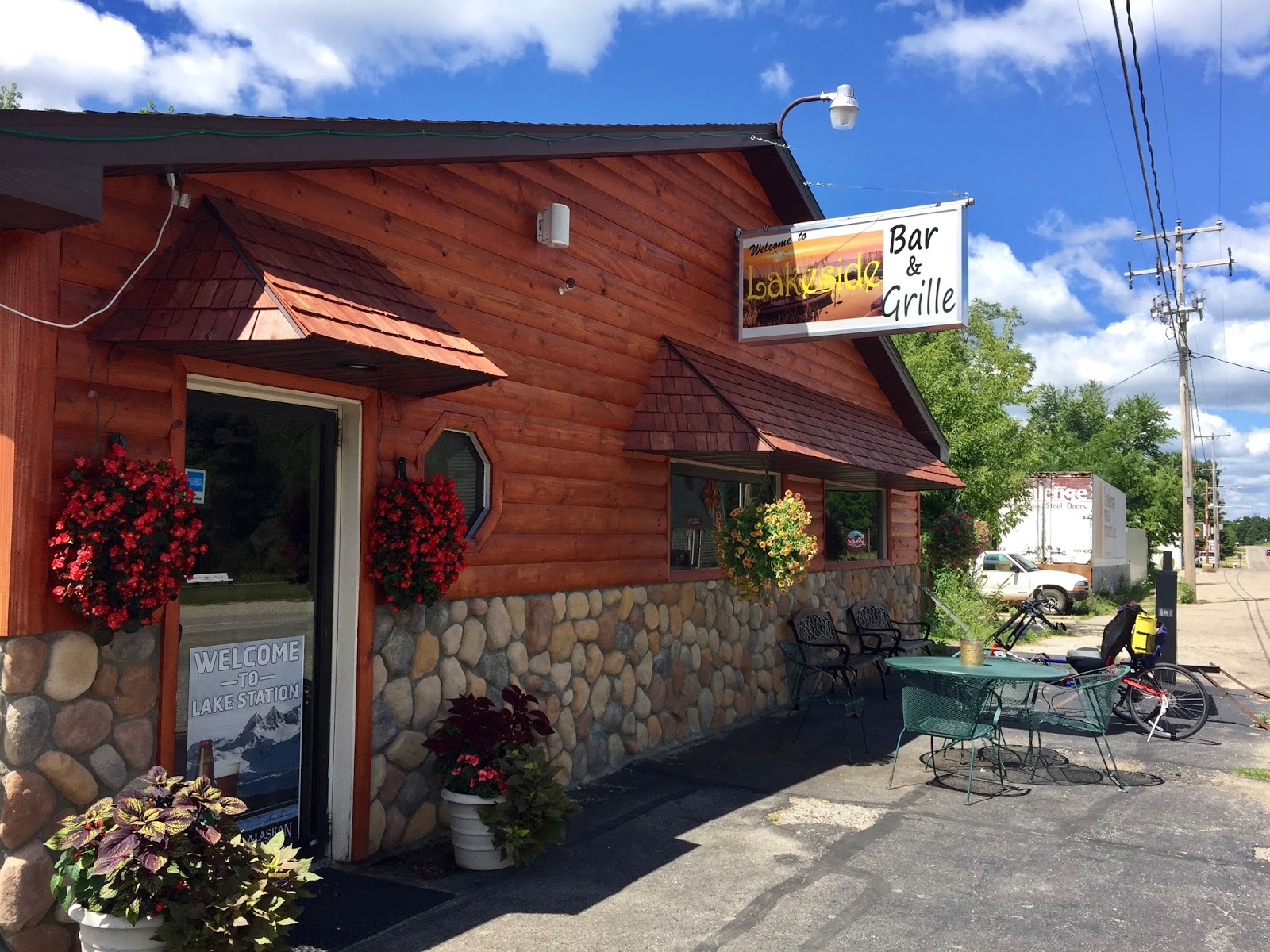
On the right is the Lakeside Bar and Grill where we had lunch.

Before leaving town we went to this old General Store to check it out.  It had a little of everything!
We selected a package of trail mix for an energy boost on our ride.
Rail Trails have a max of 3 - 5 % grades, which is one reason we prefer riding them over other trails.

From Evart we noticed a small change in elevation during most of our ride into Lake.  We had been slowly climbing!


Just outside of Lake is the coal chute or coaling station used to resupply the train.  We have seen refilling stations before and they are usually situated at the top of the grade.  So when we came to this coaling station we knew we would be going down hill on our way to Farwell.

Farwell is about 8 miles from Lake, where we had lunch.  The landscape remains every bit as enchanting.

One of my favorite sites on our rides is the remarkably tall trees. Pictured on the left are some of those trees.  Wow!
On the right is a field of wildflowers and  tree branches.
Picturesque!
This picture is of a marsh where a beaver or perhaps several beavers have made their home.  Their construction site looked massive!

After 21 miles we reached Farwell and turned around at Little Field Park.  We then began our ride back to Evart.  The total miles for this ride were 42.  It was our biggest ride of the year and our longest on our recumbent bikes to date.  We both did very well on the ride and the mild temperatures helped make that possible.  There was a moment on about mile 33 that I was wishing my bike seat could be "fluffed" a bit!  HaHa!  We arrived back at our car in Evart around 5:00 pm.

Clare, MI is on our way to Midland where we are staying a couple of nights while riding nearby trails.  In Clare there is a bakery which has been in constant business since 1896.  In 2009 when the business (Clare City Bakery) was within weeks of closing its doors, the police officers of Clare (all 9 of them) went together and saved the historic business.  Thus the name "Cops and Doughnuts"!  On an interesting side note, a friend in our RV park said that this bakery was in their family at one time, owned by her grandparents!  It is so fun to learn the history of such places!


Chippewa Trail - Midland, MI


The Chippewa Nature Center is located southwest of downtown Midland, MI very near where the Pine and Chippewa Rivers come together.  The trailhead offers shade, restrooms, water, and ample parking.
When we arrived at 8:15 am it was 53 degrees F and there were already a good number of cars.  Some folks had arrived early to hike the trails throughout the area, and there were others who had arrived to lead or participate in a nature day camp for children ages 3 through 16.  We saw these kiddos outside getting ready for their adventures and they were having a ball!
3.5 miles to Midland
  

 Parts of the trail are lined with beautiful trees.


 Some parts of the very flat trail are straight, other parts have curves.  There are a few wood bridges, and several marshes.

Here the trail runs between ball fields

In this area the trail reveals extensive marsh areas and wetlands.


On the left is Chris on one of the bridges over a marsh.  On the right are blackberries.  There was a man in the blackberry patch helping himself to what looked like about 3 quarts of big ripe berries!


This is the "tridge" located at the end of the Chippewa Trail.  It is a three-way wooden bridge for bikers or walkers.  The structure opened in 1981 and spans the confluence of the Chippewa and Tittabawassee Rivers near downtown Midland.

Today's ride was 7.2 miles total.  Because the day was still young we headed over to the Dow Gardens in Midland for more sightseeing.

We both enjoyed this trail and the beauty of nature.  This trail can best be enjoyed with bug spray applied liberally.  Have fun riding this scenic trail on Michigan's east side!

Sunday, June 11, 2017

Pictured Rocks - Munising, MI

Pictured Rocks, Munising, MI

We parked our RV at the Whispering Valley Campground in Rapid River on Friday afternoon. This is a beautiful campground on the south side of Michigan's Upper Peninsula.

Saturday we drove north in our car to Munising to view the Pictured Rocks and then do some exploring.  Munising is located on the south side of Lake Superior.


Once in Munising we parked on a street near the marina and walked to Binsfeld Bayshore Park where it was evident that there was a big event taking place today.  We found ourselves right in the middle of Pictured Rocks day!  The cruiseline was offering free cruises to the beautiful rock formations for all Yoopers!  Yoopers are the brave folks who live in Michigan's Upper Peninsula, connected to the Lower Peninsula by the Mackinac Bridge.  We drove to the U.P. via Wisconsin, which was a beautiful drive.
I used the term "brave" for the Yoopers, as the land here is very rugged.  Few cities, mostly two-lane roads, miles and miles of untouched forests, and an occasional rustic campground.  We were unable to get a reservation in one of the campgrounds near Municing.  We hear those start taking reservations in October for the following summer.

Such an exciting day is in the forecast for Munising!  Booths are set up with all kinds of local foods, drinks, and memorabilia for sale.


We are here for the cruise and wait in line to board the catamaran.  There are no reserved seats and we are hoping to get an outdoor location on the second level.  We did get that location and were in a prime position for taking pictures.
The day started out with mist, overcast skies with temps in the 60s, and light winds.
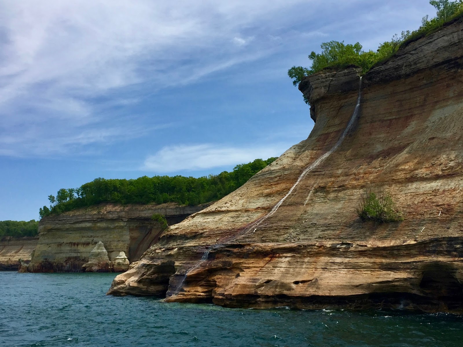
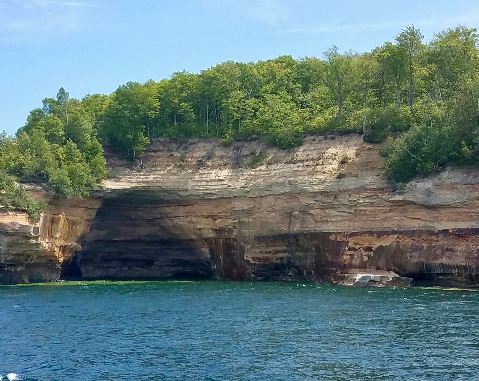
Within an hour the sun came out and we were able to get some beautiful pictures as seen below.
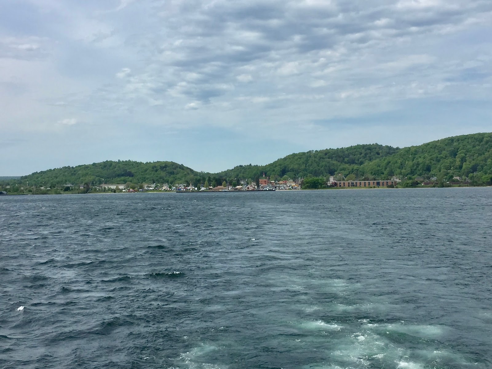
The landscape around Munising
Beautiful Lake Superior
The rocks are sandstone and the "pictures" are created by mineral deposits from the water.  We enjoyed seeing all of this natural beauty and these are the pictures that turned out with the best colors.


Old East Channel Lighthouse
After the cruise we noticed that the celebration on shore was in full swing.  People were out enjoying a live band, a clown for the kiddos, and the many vendors.
We walked a short distance to our car and left our jackets, then had lunch at The Navigator restaurant.  The food was delicious and from our table we had a view of the harbor.

While in the area we drove a few blocks to see the Horseshoe waterfall.


There are other waterfalls in the area which would be better to visit.  We chose this one because it was nearby.

It was around 2:30pm and we decided to drive to Marquette.  It would be about a 45 minute drive.  We had thought about riding bikes tomorrow in Marquette and decided to check out the trails before making the trip with the bikes.  Pic on the right shows a portion of the bike trail we were considering along Lake Superior.
The wind picked up considerably after we finished the cruise.  My guess is that winds were sustained at 22 or more with gusts to 40+.  There were whitecaps on Lake Superior as we drove around town on Lakeshore Blvd.  The people at the welcome center highly recommended that we visit Presque Isle Park, which is free to the public.

 This is what our drive looked like through Presque Isle Park.  Beautiful trees, playgrounds, and a few small beach areas.  It was recommended that we not miss the black rocks located at the very tip of this park.  We found these lava-formed rock formations and parked to investigate.  While walking around we encountered four different wedding parties, complete with photographers, taking wedding pics!
Black Rocks - a lava formation

 On the left is a pic of the bride's maids of one of the wedding parties.  Immediately upon seeing this I was reminded of the movie "O Brother, Where Art Thou" and expected the lovely ladies to start singing "Go to Sleep Little Baby" at any moment.


At Presque Isle Park in Marquette
After we left the park we drove around town briefly and then began our trip back to Rapid River.  Fun day making memories in the U. P.!