Sunday, September 20, 2015

Little Traverse Wheelway - Charlevoix to Petoskey (MI)

Charlevoix, Michigan
We arrived in Charlevoix, MI on Tuesday, September 15 around 11:15 am and just in time for a quick lunch before beginning our ride.  It was 73 degrees with clear and sunny skies promising ideal weather for our 25 mile exploration of the Little Traverse Wheelway Trail.  Charlevoix is located in the northwest of the lower peninsula of Michigan with Lake Michigan on the west and Lake Charlevoix on the east.  It is off season now which makes it easier to get a good price on a hotel.  We stayed at the Weathervane Inn where we had a view of Lake Michigan.  The picture above gives a glimpse of the main thoroughfare of town and of the Villager Pub where we had a salad for lunch.  
Our trail in the Michigan Trails Magazine

The Little Traverse Wheelway begins in Charlevoix and parallels Little Traverse Bay of Lake Michigan.  The 26 mile route ends in Harbor Springs.  If we used the trailhead at Shanahan Park we would have to ride on the street for a few blocks.  We decided to drive to the next trailhead listed on our trail guide which was Nine Mile Point Park.  
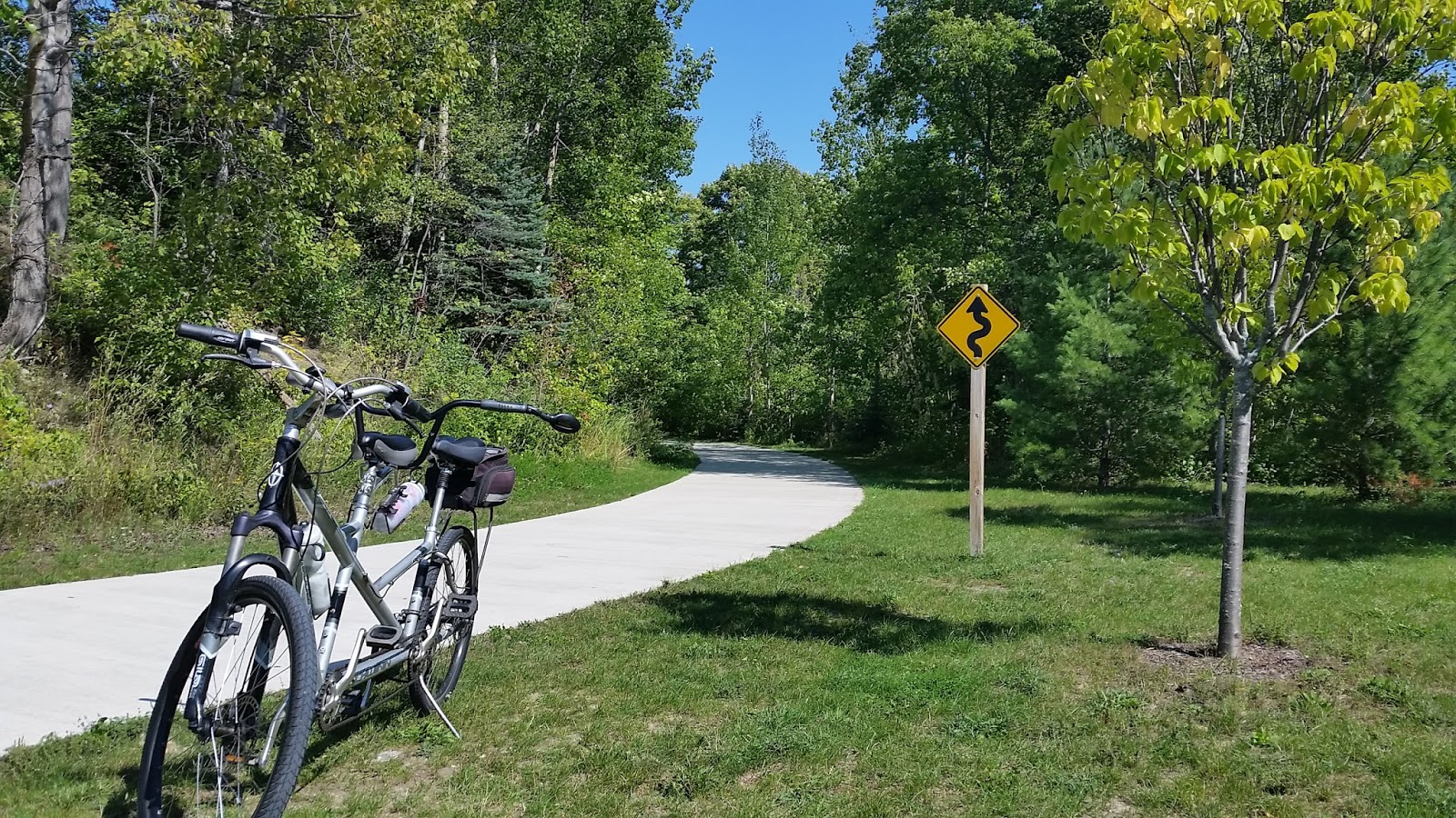
Roadside Park near Burgess road


While driving to Nine Mile Point Park we came across a rest area which made an excellent place to begin our ride to Petoskey and back. 


The trail is 8-10 ft wide, well maintained and asphalt.  To the left is Little Traverse Bay of Lake Michigan.  The water is clear and deep blue.  On the right is a pic of construction barricades warning of work being done near the trail, not on the trail.


 In the late 1800s locals used the trail for walking and for bicycling.  Later the Grand Rapids and Indiana Railroad as well as the Chicago and West Michigan Railway laid tracks along the route.  In the picture on the left you can see the steep hill we have in front of us.  The hill rose to the level of the old train track which we could see at the top of the hill.  It was in the 1990s when the Wheelway was used as a walking and bicycling path again.


 The trail presents a variety of scenes for us to enjoy.  Trees, water, canopy, and even a tunnel near Bay Shore.


One of several resorts on Bay Shore


Pics on the left and right show the view of Little Traverse Bay from the trail.


We have reached Petoskey now.  It is 78 degrees and sunny.  Our trail wraps around the St. Francis Solanus mission and offers a beautiful view of the lake. 
St. Francis Solanus Indian Mission
Behind the Mission
This trail was very well marked and we easily found our way when it became necessary to take to the street for a block or two to rejoin our trail.  


On the left is the former train station.  It is now a museum and for $3 each we took a quick tour to pick up some of the local history.  The museum highlights Ernest Hemingway's life and time spent in the Petoskey area.
Marina in Petoskey

The picture on the right is our first view of the marina.  Near the fire station and this marina we look for Mineral Well Park and the Bear River Trail.  It is denoted by the #13 marker on the Trail Guide map.

We left the Wheelway Trail and proceeded south on the Bear River Trail to check out the rapids.  On the left is the Bear River as seen from town.  It flows into Little Traverse Bay of Lake Michigan.


We admired the construction of the bridge pictured here as we biked along the Bear River.


On the left is a picture of our bike parked along the Bear River Trail.  
On the right is a pic of the steps Chris walked down to get a picture of the rapids on Bear River.


We did not ride all the way to the Sheridan Street Trailhead.  Instead, we turned around here and rode back to the Petoskey Bayfront Park and took more pictures there.


The day was unseasonably warm and incredibly beautiful.  When we returned to the roadside park in Charlevoix the temp had reached 81 degrees and we had ridden 25 miles.  This is definitely a trail we would ride again.


Sunday, August 16, 2015

Holland (Metro Area Trails) to Saugatuck (MI)

 The Holland metro area claims to have an extensive network of paved trails.  This may be true if you were to count streets with cars on them and no marked bike lane.  Wednesday, August 12 we decided to ride from Holland to Saugatuck using our Michigan Trails Magazine as a guide and relying on our GPS and trail markers when in doubt.  The good news was that all the roads we traveled were paved.  Markers were nonexistent, which made for a very interesting ride.
We first planned to begin our ride from the Dunton Park Trailhead in Holland which was a 55 minute drive from our campground in Muskegon.  When we arrived in Holland we discovered that beginning at Dunton Park meant riding either street or sidewalk to get to the Unity Bridge pictured on the left.  We would need to cross that bridge so we decided to park at the CVS instead.  This change of location meant easy access to the biking/walking path across Lake Macatawa.
On the left is Lake Macatawa from the Unity Bridge.  On the right is our "bike path".  It was horrible navigating these barriers every few feet.  We probably weaved through 10 or 12 of these.  We could have ridden the street but I don't like riding with cars.

 There was a lot of industry in the northern part of Holland.  One thing I did enjoy seeing was quite a bit of art formed from steel.  It was very similar to some of the art we have seen in Grand Rapids at Art Prize.  On the left is a pic of one of the displays.
Along this path we saw a farmer's market in progress.  Somewhere just past the market we lost our trail.  We made a turn and found ourselves in the old part of downtown Holland.  We consulted our trail map and our phone GPS.  After awhile we found ourselves in front of a bicycle shop.  Eureka! As soon as we got off our bike a lady came out who worked at the shop and was eager to give directions to Saugatuck, MI.  She and others make the ride frequently and knew the route we were seeking.
It was about 35 minutes after parking at the CVS, biking through town and through housing editions, that we found our trail.  Absolutely no signs whatsoever to help us.  But that was okay.  We were in no hurry and people were very kind to give assistance and to not run over us on the streets.  They seem to be quite used to bikers riding all over town.
Trail runs parallel to road
Forested section of trail

Finally, we acquired our trail. The Beeline Trail south of Holland passed through beautiful residential areas and parallels Beeline Ave. 


 The above photo shows a crop of grapes.  We also traveled alongside fields of wild flowers and fields of corn.


 By 11:15 am we had traveled nearly 12 miles and had reached the northern area of Saugatuck.  It was now 71 degrees and a bright sunny day.  We could have traveled further south into the town of Saugatuck, but thought it best to start back to Holland.  This time we felt sure we could find the unmarked trail and avoid the old downtown area.
Such beautiful fields and wildflowers
A unique structure which I will call a "barn" caught our eye on the way south.  We decided on the way back north we would get a picture.  I had envisioned a structure similar to this many times in the past thinking that someday we might want to park our rig in a permanent structure - one that we might be able to live in as well.  When we got to the barn we noticed the owner was outside the house watering her garden.  We peddled into her driveway and complimented her on the unique building beside her home.  To our surprise she invited us to take a tour of the barn.


Oh my goodness!  It was amazing inside.  Bathroom and shower.  A climbing wall for the grands.  A loft.  Plenty of room for an RV, boat, and cars.  Her husband had designed and built this grand garage and we had been trusted with a viewing.  WOW!  This could very well have been my favorite part of the ride.  The lady told us how they love Michigan and this area in particular.  Even during the winter they could always go into town.  Her husband has the equipment to clear their driveways.  After a snowfall the roads are continually cleared.  She also told us that Holland has heated roads and sidewalks.  I looked it up and they do!  Warm water circulates through underground tubing in the downtown area keeping the area free of snow (which they get a great deal of)!
We took pictures inside and out for future reference, said thank you one more time, and took off down the trail again.
 This is the Kollen Park entrance in Holland and would be an excellent trailhead for the next ride to Saugatuck.  Located on Lake Macatawa this park offers plenty of parking, tons of space for bringing out the lawn chairs and soaking up the afternoon sun.  We saw a gentleman enjoying his day by fishing from the path.  We think this was part of the Holland Shoreline Trail, but, once again, there are no signs.
Panoramic view of Lake Macatawa and the bicycle/walking area
The grouping of pics below all show the area surrounding the lake.  The restaurant pictured on the right is the Boatwerks Restaurant and Lounge.  It appeared to be a popular dining destination on the lake.
Below is the Farmer's Market we had so hurriedly cycled past earlier in our ride.  This time we made a stop.  Unfortunately, many of the booths were packing up and heading home.  We were able to check out 3 or 4 booths who were hoping for last-minute customers.  One in particular that I liked had granola for sale.  They also had samples so we could check it out before buying.  I always like samples.  Thankfully, there was room in our bike bag for a sack of locally-made granola.
Eighth Street Market Place
 The return trip was turning out to be so nice.  We seemed to locate our streets/paths without any difficulty.  I had accepted that our route would include street and sidewalk travel along with dedicated bike paths.  In changing my expectations I was able to enjoy more of the ride.
When we chose our trailhead it was so that we could ride over the lake.  Here we are again, preparing to cross over the lake.
Kayakers on the lake
 This is where our bike path took an interesting turn.  We could continue on the current path, cross over the lake and then cross over to our CVS parking lot at a major intersection about a half mile ahead or we could use the bike path shown below to make the crossing over and miss the busy intersection.  I'm all about missing out on traffic.  In the pic on the left our current bike path is on the right and we are heading for the path that is sloping downward on the left of the pic.  The path is going under the bridge.
 The picture on the right is taken from the bike path just before going under the bridge.  You can see we are much lower now.  And the picture below is a shot from under the bridge where we are water level.  Water is on our path from where a boat came through and splashed.

 The bike path goes under the bridge then climbs to the path we had taken earlier in the day to cross the lake.  Now that was cool!  Loved this finale to the ride!


Friday, August 14, 2015

Musketawa Trail - Muskegon to Ravenna (MI)

On a bridge near Ravenna, MI
The Musketawa Trail lies on what was originally the Central Michigan Railroad.  The 26-mile rail bed was acquired in 1992 and made into the beautiful bike trail shown.  The trail stretches between Muskegon and Grand Rapids where it turns into the Fred Meijer Pioneer Trail.  We are riding half of the trail today making a round trip total of 25 miles.  It was 74 degrees at 10:15 am on Tuesday, August 4 when we began our ride at the staging area on Broadway Street in Muskegon, MI.  Our destination is east of us to the town of Ravenna.  We have ridden this trail 3 or 4 times in the past 6 years because it is not all that far for us to travel to begin the ride.
The pic on the left shows the trailhead and our entrance to the trail.  The entire trail is paved with asphalt, is wide and well maintained.  There is not a lot of canopy on this trail so it is a trail that we avoid during the hottest part of the summer.

Just a few miles from our trailhead in Muskegon we find the most unusual grouping of "facilities" that we have ever seen along a bike path.  What more could a biker/walker need?

During our ride to Ravenna we observed farms on both sides of the trail.  There are corn crops, beans (we think soy), and blueberry fields.  There are blueberry stands throughout this area of Michigan all summer long, or so it seems.  The picture on the left is one of many blueberry fields.  On our way back to Muskegon this field was full of workers picking blueberries.


After 12.5 miles and approximately an hour of biking (and taking pictures) we reached Ravenna.  The picture on the left is the trailhead in Ravenna.


Our destination was Ravenna Roundtable Restaurant for a light lunch before heading back to Muskegon.  Service was good, prices reasonable, and food acceptable.  While at lunch two bikers came in and we were able to visit with them a few minutes.  Their ride had started from the Grand Rapids area, the opposite end of the trail from ours.  While visiting with the couple they mentioned that we would notice a big difference in our ride back to Muskegon.  Evidently the wind had picked up and we would be riding into about a 20 mph wind.

Ravenna (pronounced Rah-Vannah) is a community of approximately 1200.  Pics on left and right give a glimpse of the town.
This trail is not as interesting or as "pretty" as many that we have ridden in Michigan, but it is smooth and good for a biking workout.  The wind was formidable as we made our way back to our trailhead. As we reached our trailhead and car, we saw a man sitting at a nearby picnic table.  We had seen this man earlier today heading west as we were heading east and here he was next to our car with his face buried in the biking magazine that all of us Michigan bikers use as a guide.  He also had an atlas open on the table.  When we stopped at our car and started unloading our bike we had the opportunity to meet this remarkable man.
We want you to meet Chet.  He was headed for the P.J. Hoffmaster State Park in Muskegon.  Earlier in the day he began his ride just outside of Grand Rapids and estimated he had ridden 40 miles thus far.  As you can see from the pics he was on a trike and was pulling a small, but fully loaded, trailer.  Upon reaching the state park he was going to camp and stay a couple of nights.
The timing of our return was no accident.  Chet's face was buried in the trail guide for a reason.  He is legally blind.  He also has Multiple Sclerosis.  Because this trail literally ends here, he must use city streets (with bike lanes hopefully) to get to the state park on the west side of town.
Chris was able to pull the park up on his phone and find the appropriate streets for Chet to travel to reach his destination.  We had quite a visit with this very nice man.  He told us about his bike/trike and modifications he had made.  He has a kinetic energy recovery system and 2 batteries to help him out if or when the going got to be too much.
Meeting Chet was the highlight of our ride today. This dear man had much he could have complained about, but he didn't.  His focus was all about plans he had made and things he wanted to accomplish.  His attitude and approach to life was inspirational.  We wished him well on his life journey and God's blessings before heading home.