 |
| Pictured Rocks, Munising, MI |

We parked our RV at the Whispering Valley Campground in Rapid River on Friday afternoon. This is a beautiful campground on the south side of Michigan's Upper Peninsula.
Saturday we drove north in our car to Munising to view the Pictured Rocks and then do some exploring. Munising is located on the south side of Lake Superior.
 Once in Munising we parked on a street near the marina and walked to Binsfeld Bayshore Park where it was evident that there was a big event taking place today. We found ourselves right in the middle of Pictured Rocks day! The cruiseline was offering free cruises to the beautiful rock formations for all Yoopers! Yoopers are the brave folks who live in Michigan's Upper Peninsula, connected to the Lower Peninsula by the Mackinac Bridge. We drove to the U.P. via Wisconsin, which was a beautiful drive.
Such an exciting day is in the forecast for Munising! Booths are set up with all kinds of local foods, drinks, and memorabilia for sale.


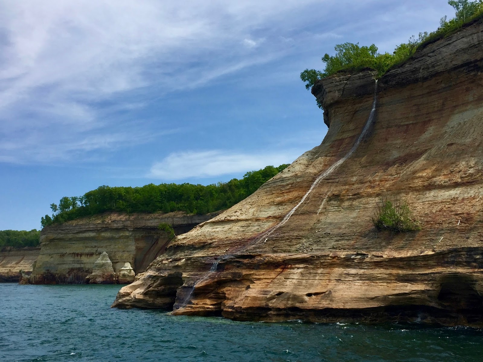
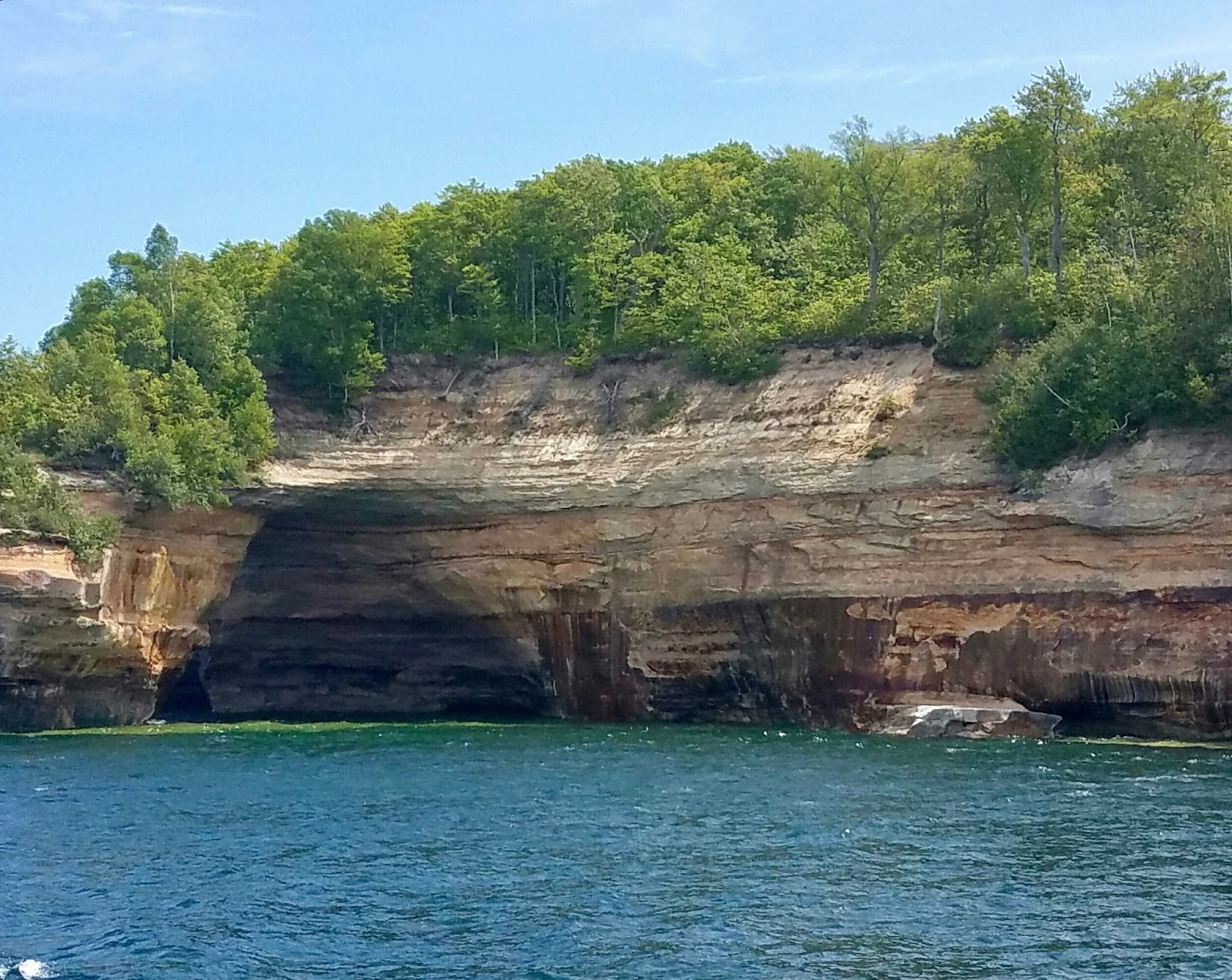
We are here for the cruise and wait in line to board the catamaran. There are no reserved seats and we are hoping to get an outdoor location on the second level. We did get that location and were in a prime position for taking pictures.
The day started out with mist, overcast skies with temps in the 60s, and light winds.
Within an hour the sun came out and we were able to get some beautiful pictures as seen below.
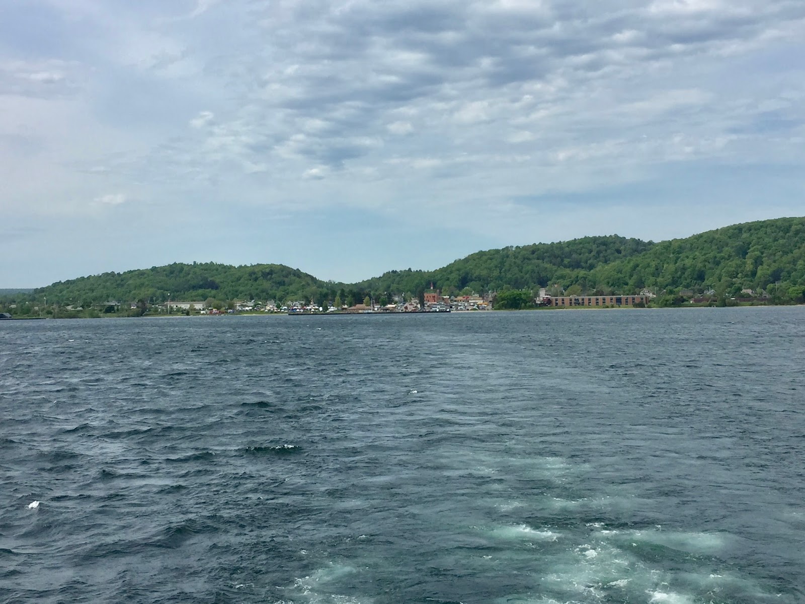 |
| The landscape around Munising |
 |
| Beautiful Lake Superior |


 |
| Old East Channel Lighthouse |

 After the cruise we noticed that the celebration on shore was in full swing. People were out enjoying a live band, a clown for the kiddos, and the many vendors.
We walked a short distance to our car and left our jackets, then had lunch at The Navigator restaurant. The food was delicious and from our table we had a view of the harbor.
While in the area we drove a few blocks to see the Horseshoe waterfall.
 There are other waterfalls in the area which would be better to visit. We chose this one because it was nearby.
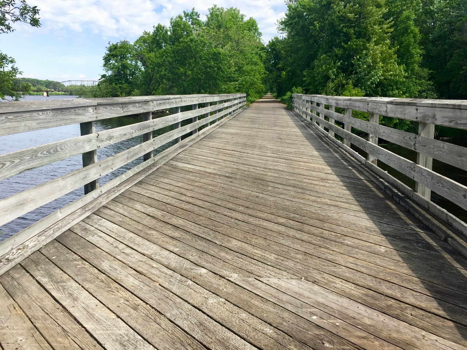
 It was around 2:30pm and we decided to drive to Marquette. It would be about a 45 minute drive. We had thought about riding bikes tomorrow in Marquette and decided to check out the trails before making the trip with the bikes. Pic on the right shows a portion of the bike trail we were considering along Lake Superior.
The wind picked up considerably after we finished the cruise. My guess is that winds were sustained at 22 or more with gusts to 40+. There were whitecaps on Lake Superior as we drove around town on Lakeshore Blvd. The people at the welcome center highly recommended that we visit Presque Isle Park, which is free to the public.

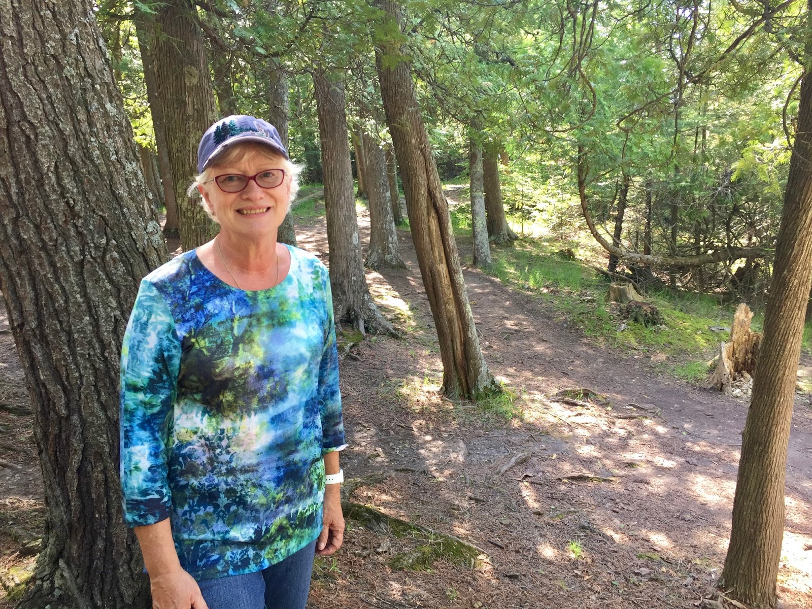
This is what our drive looked like through Presque Isle Park. Beautiful trees, playgrounds, and a few small beach areas. It was recommended that we not miss the black rocks located at the very tip of this park. We found these lava-formed rock formations and parked to investigate. While walking around we encountered four different wedding parties, complete with photographers, taking wedding pics!
 On the left is a pic of the bride's maids of one of the wedding parties. Immediately upon seeing this I was reminded of the movie "O Brother, Where Art Thou" and expected the lovely ladies to start singing "Go to Sleep Little Baby" at any moment.
After we left the park we drove around town briefly and then began our trip back to Rapid River. Fun day making memories in the U. P.!
 There are other waterfalls in the area which would be better to visit. We chose this one because it was nearby.
 It was around 2:30pm and we decided to drive to Marquette. It would be about a 45 minute drive. We had thought about riding bikes tomorrow in Marquette and decided to check out the trails before making the trip with the bikes. Pic on the right shows a portion of the bike trail we were considering along Lake Superior.
 The wind picked up considerably after we finished the cruise. My guess is that winds were sustained at 22 or more with gusts to 40+. There were whitecaps on Lake Superior as we drove around town on Lakeshore Blvd. The people at the welcome center highly recommended that we visit Presque Isle Park, which is free to the public.

This is what our drive looked like through Presque Isle Park. Beautiful trees, playgrounds, and a few small beach areas. It was recommended that we not miss the black rocks located at the very tip of this park. We found these lava-formed rock formations and parked to investigate. While walking around we encountered four different wedding parties, complete with photographers, taking wedding pics!
 |
| Black Rocks - a lava formation |

 |
| At Presque Isle Park in Marquette |


